Top Hiking Trails in San Diego County
7 of the most popular hiking trails in San Diego – including user reviews, pros / cons, and difficulty level
1. Mt. Woodson Trail, aka “Potato Chip Rock” (Poway – San Diego, CA)
Mt Woodson Trail, Poway, CA 92064 – Get Directions
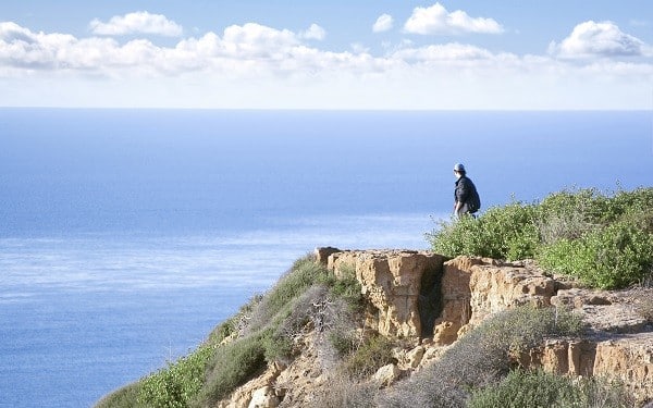
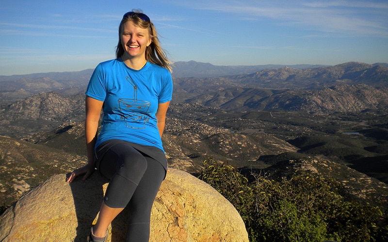
Mount Woodson Trail, also known as “Potato Chip Rock,” is one of the most strenuous of the well maintained hiking trails in San Diego. Depending on the time of year, many parts of the trail are lined with beautiful wildflowers and interesting plant life. The trail is approximately 7 miles out and back, which can typically be hiked within 3-4 hours depending on experience level. At the top of the hike, there is the infamous “Potato Chip Rock,” where you will most likely have to wait your turn to snap a photo.
DIFFICULTY LEVEL: Strenuous
REVIEWS: 4 ½ stars; 531 reviews (view on Yelp)
PROS: One of the best parts of this hike is the photo opp at the top. Make sure to bring your camera!
CONS: The hike itself is virtually shade-less. Make sure to wear plenty of SPF, sunglasses, and protective clothing.
PARKING: Lot parking is $5 and opens at 6AM.
2. Iron Mountain Trail (Poway, San Diego, CA)
Hwy 67 & Poway Rd, Poway, CA 92074 – Get Directions
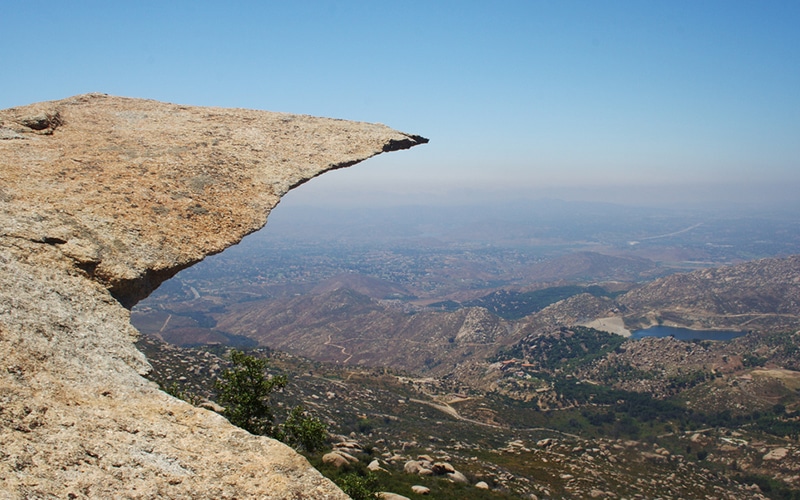
Iron Mountain Trail is an approximate 6 mile round-trip trail located just outside of Poway in San Diego county. The hike is less strenuous than Mt. Woodson, but still offers a great workout. On a clear day, you may be able to see all the way to San Clemente and the Catalina Islands. Once you make it to the top, there are a couple of picnic tables where you can catch your breath and take in the beautiful scenery.
DIFFICULTY LEVEL: Moderate to strenuous
REVIEWS: 4 ½ stars; 28 reviews (view on Yelp)
PROS: This trail is well maintained and is open to mountain biking, horseback riding, and dogs are welcome.
CONS: Don’t let the shady beginning of the trail fool you – there is virtually no shade on this hike. It is best to visit Iron Mountain either early in the morning or evening hours.
PARKING: Free lot and street parking available.
3. Cowles Mountain (San Carlos – San Diego, CA)
Golfcrest Dr & Navajo Rd, San Diego, CA 92119 – Get Directions
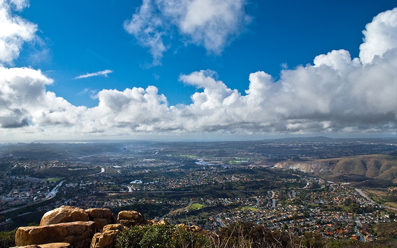
Cowles Mountain (pronounced “Kohl’s” Mountain) is one of the most popular hiking trails in San Diego, and is enjoyed by hundreds of people each day. The hike to the top is approximately 1.5 miles, which makes it a popular destination for people of all ages and fitness levels. The summit at the top is a spacious, open area, with plenty of large rocks to sit on and enjoy the views of Lake Murray, Downtown San Diego, and the Pacific Ocean..
DIFFICULTY LEVEL: Moderate
REVIEWS: 4 stars; 480 reviews (view on Yelp)
PROS: The top of the trail boasts beautiful 360-degree panorama views of San Diego county.
CONS: This trail is very popular, so it can get quite busy during peak hours.
PARKING: The parking lot is free, but very small. Street parking is plentiful.
4. Los Penasquitos Canyon (Torrey Hills – San Diego, CA)
12115 Black Mountain Rd, San Diego, CA 92129 – Get Directions
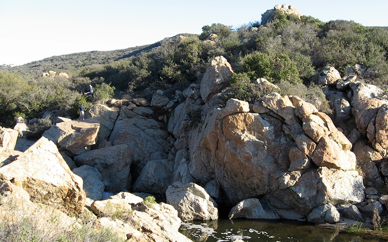
Los Penasquitos Canyon is a 6.1 mile trail near Rancho Penasquitos and Mira Mesa, California. Because it is a relatively flat hike, it is very family and dog friendly and is great for walking, running, biking, and horse back riding. The main trail is about 3.1 miles long with a creek and waterfall area at the end. There are plenty of things to see at the Los Penasquitos Canyon Preserve – make sure to check out this map to plan your visit.
DIFFICULTY LEVEL: Easy to moderate
REVIEWS: 4 stars; 134 reviews (view on Yelp)
PROS: Because this trail is shaded and relatively flat, it is especially great for beginners and dog owners.
CONS: If you’re looking for a strenuous hiking experience, this may not be the best trail for you.
PARKING: Free parking is available in the back of the Canyonside Community Park. If this lot is full, there is a designated lot at the crossing of Mercy and Black Mountain Rd. for a $3 flat-rate fee.
5. Cabrillo National Monument / Old Point Loma Lighthouse (Point Loma – San Diego, CA)
1800 Cabrillo Memorial Dr., San Diego CA 92106 – Get Directions
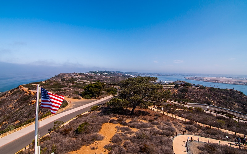
The Cabrillo National Monument is located at the southern tip of Point Loma and commemorates the 1542 landing of the first European expedition to step foot on what later became the West Coast of the United States. The highest point in the park offers outstanding views of San Diego’s skyline and harbor, and Coronado.
DIFFICULTY LEVEL: Moderate
REVIEWS: 4 ½ stars; 338 reviews (view on Yelp)
PROS: Once you are finished with your workout, there are many fun things to do. Admission includes access to the Cabrillo Monument museum and visitor’s center, the Old Point Loma Lighthouse, tide pools, and hiking trails.
CONS: The area can also get somewhat crowded on weekends depending on the time of year.
PARKING: Cost for admission is $5 per car (admission is good for a week).
6. Torrey Pines State Reserve (La Jolla – San Diego, CA)
12600 N Torrey Pines Rd, La Jolla, CA 92037 – Get Directions
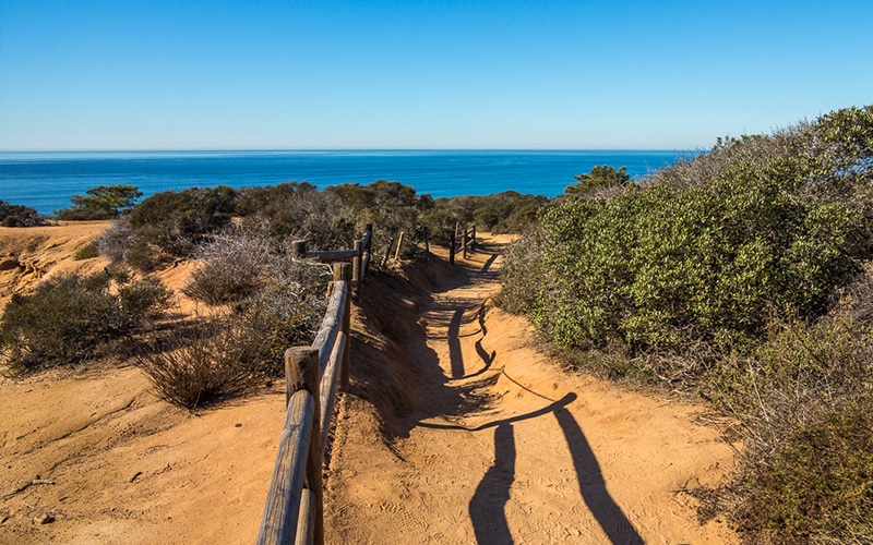
The Torrey Pines State Reserve is one of the most beautiful spots in San Diego County. With several hiking trails at different intensities, this is a good choice for hikers of all levels.
DIFFICULTY LEVEL: Easy to moderate
REVIEWS: 5 stars; 517 reviews (view on Yelp)
PROS: The views at Torrey Pines State Reserve are absolutely gorgeous. There is a visitor center with volunteer guides that are happy to answer any questions you may have.
CONS: Parking is expensive. If you plan on visiting regularly, annual passes are available.
PARKING: There is a $15 fee to park in the lot. Yelp reviewers recommend arriving early for a better chance at snagging a spot on the street.
7. Cedar Creek Falls; aka Devil’s Punch Bowl (Ramona – San Diego, CA)
15519 Thornbush Rd, Ramona, CA 92065 – Get Directions
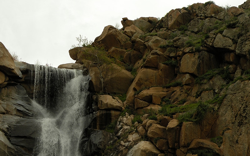
The hike to Cedar Creek Falls is a moderately difficult six miles round-trip. Unlike most other trails, this trip requires downhill hiking on the way to the falls and uphill on the way back. The strenuous hike from Cedar Creek Falls back up to the main trail-head requires over two miles of steady, challenging uphill hiking. You shouldn’t attempt this hike unless you are in good physical shape, and you should leave your dog at home. It is strongly recommended that visitors bring a printed copy of your paid visitors permit ($6 non-refundable transaction fee). Government photo identification is also required. For more information on rules and regulations, click here.
DIFFICULTY LEVEL: Strenuous
REVIEWS: 4 ½ stars; 168 reviews (view on Yelp)
PROS: Although difficult, this hike is very rewarding.
CONS: Temperatures can exceed 115 degrees during the summer months and there is virtually no shade.
PARKING: There is a free lot and plenty of street parking available.

Join our Senior Wellness Society for the latest news on Medicare and tips for healthy living in San Diego!
Sign up now ›Are you looking for specialized medical care in San Diego?
Our directory has more than 850 doctors in San Diego County of various specialties who are available to help you.
Find a doctor